 |
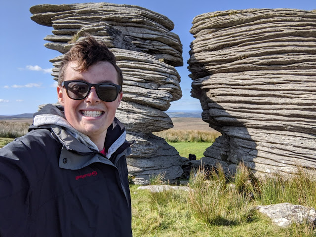
| The Thirlstone at Watern Tor |
This was the fourth leg of the Perambulation and a walk we were all looking forward to more than the others since it takes in some great areas and the most beautiful tor on the moor - and no, I'm not biased.
We set off from the Warren House Inn, though this time with the same members as the last walk, to go in search of an annoying conundrum about where exactly the King's Oven is located. This boundary point is either the cairn atop Water Hill (unlikely) or a ruin on the eastern slopes where we were. Near the v stones, there is a low, ruined structure which must be it.
 |
| King's Oven Possible Location SX 67521 81354 |
 |
| Vermin Trap with Two ‘V’ inscribed stones |
We joined the Two Moors Way to get us to Hurston Row, a fine double stone row, before heading north to the Heath Stone and Fernworthy Reservoir.
 |
| Hurston Row |
 |
| Hurston Row Terminal Stone SX 67320 82562 |
 |
| The Heath Stone |
 |
| Fernworthy Reservoir |
We crossed the footbridge and headed up onto Thornworthy Down to visit the tor of the same name, a stunning viewpoint and spot for a break.
 |
| Thornworthy Tor |
 |
| Thornworthy Tor |
 |
| Thornworthy Tor |
Crossing a small stream and passing through a gate, we negotiated some cattle to reach our next checkpoint: The Longstone.
 |
| The Longstone |
Over Shovel Down, we came to the wide track between Kes Tor and Long Ridge, although we didn't stay on it for long as the group had spotted a rock pair which reside on the boundary. One of these is inscribed 'GP' for Gidleigh Parish and was spotted by Amanda.
 |
| GP inscribed on Boundary Stone SX 65243 85458 |
 |
| GP inscribed on Boundary Stone SX 65243 85458 |
The route now was to Stone Tor, straddling a wall, to see the huge GP on top of the ruined tor. After failing to find the benchmark here, we continued over Dogleg Hill to Manga Rails where I noticed a plaque and Sheron lost her lens cap for her camera.
 |
| Stone Tor |
 |
| Gidleigh Parish Boundary Mark on Stone Tor |
 |
| Manga Rails Plaque SX 63994 86034 |
 |
| Manga Rails, Sheron crossing |
Hugh Lake Ford crossed, we made uphill to a track that heads to Hawthorn Clitter, although this soon becomes consumed by gorse and we enter territory where you can't see what's under your feet. The only dog with us, Bryony, was behind me which is good since I spotted an adder curled up and sunbathing in our path, but me warning/calling the others caused it to move into the gorse, but I still managed a couple of mediocre shots showing what I believe to be a female; more pale than others I have seen.
There are at least two boundary rocks amid Hawthorn Clitter, one bearing GP and another just a G.
 |
| Adder below Hawthorn Clitter |
 |
| GP Boundary Rock, SE of Hawthorn Clitter |
 |
| Hawthorn Clitter G Boundary Rock |
Through a wall gap and we were at Watern Down Tor, an emergent tor brought to my attention by Bob Fitzpatrick. It is quite a substantial elongated rock face, but the reeds at its foot obscure its real size.
 |
| Watern Down Tor |
 |
| Watern Down Tor |
 |
| Watern Down Tor |
Watern Tor never fails to disappoint, and it is still my all time favourite tor and I really can't fault it. The light was illuminating the horizontal layers perfectly and we sat down at The Thirlstone for lunch.
 |
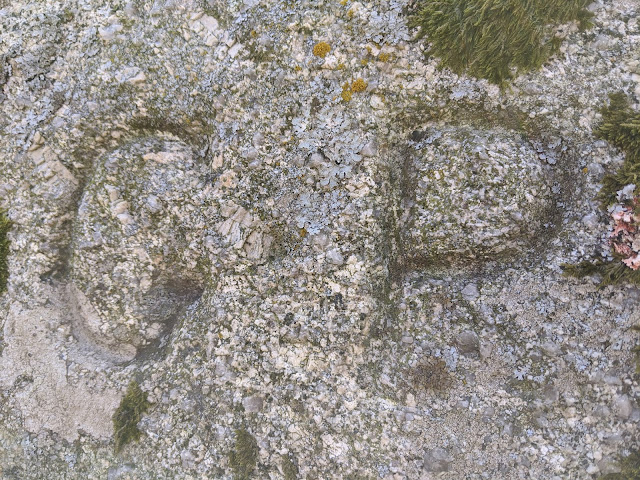
| GP inscribed into The Thirlstone |
 |
| Watern Combe |
 |
| Wild Tor Clitter |
 |
| Wild Tor Well SX 62731 87635 |
We took the track that runs in the col between the hill of Headon and Wild Tor, in the northerly direction of Hound Tor which has 'TP' inscribed onto its east face denoting Throwleigh Parish.
 |
| Hound Tor (Okehampton) |
 |
| Hound Tor TP Inscription SX 62887 89010 |
 |
| Hound Tor TP Inscription SX 62887 89010 |
From here the route was extremely easy and well-known to all of us, heading northward once again to the White Moor Stone and Stone Circle, before Sheron and I took a quick detour off of Little Whit Hill to view the outcrop spoken of as Little Hound Tor.
 |
| White Moor Stone |
 |
| White Moor Stone Circle |
 |
| Little Hound Tor |
 |
| Little Hound Tor |
 |
| Little Whit Hill |
Although the southerly approach to Cosdon is said to be the easiest, and this is believable when looking at the map, it is still a slog and unlike the northerly approach, the cairn comes into sight last-minute.
Cosdon Hill has its beacon and 360-degree summit views, but there are also remnants of a tor on its western and south-western slopes straddling the footpath due west to Horseshoe Ford and Queenie Meads.
 |
| Cosdon Beacon |
 |
| Cosdon Hill Trig Point |
 |
| Cosdon Hill |
 |
| Cosdon Hill Outcrops |
Instead of beeling back to Belstone, we agreed that heading west through the extensive tinners' workings to Horseshoe Ford would be more sensible with a good path taking you all the way there. It is a steep 200 metres descent but the views of the Belstone Ridge are great.
 |
| Tinners' Workings, Cosdon Hill West Shoulder SX 62794 91504 |
 |
| Horseshoe Ford |
 |
| Horseshoe Ford |
It was a leisurely stroll back into Belstone, though with a cheeky side visit to Holloway Parson Rock, also known as the Walrus Stone and Belstone Clanger. Birchy Lake is full of interesting items, including a stone seat, abandoned machinery and a post box.
 |
| Holloway Parson Rock |
 |
| Holloway Parson Rock 'B' Inscription SX 62124 92389 |
 |
| Birchy Lake Abandoned Machinery SX 62012 93075 |
 |
| Birchy Lake Post Box SX 61986 93083 |
A cracking walk, and rather exciting to know that we only have one leg left before we have completed the entire route.


No comments:
Post a Comment